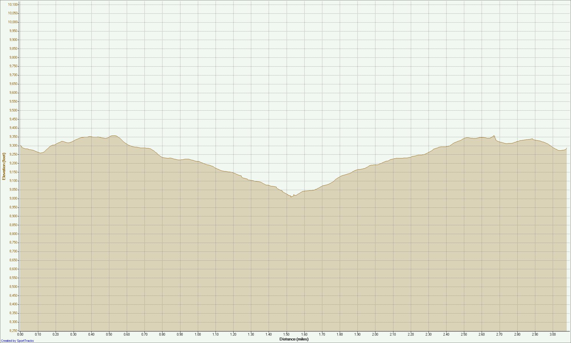
Click on the any Chart to see larger View
Altitude View
Reservoir Trail
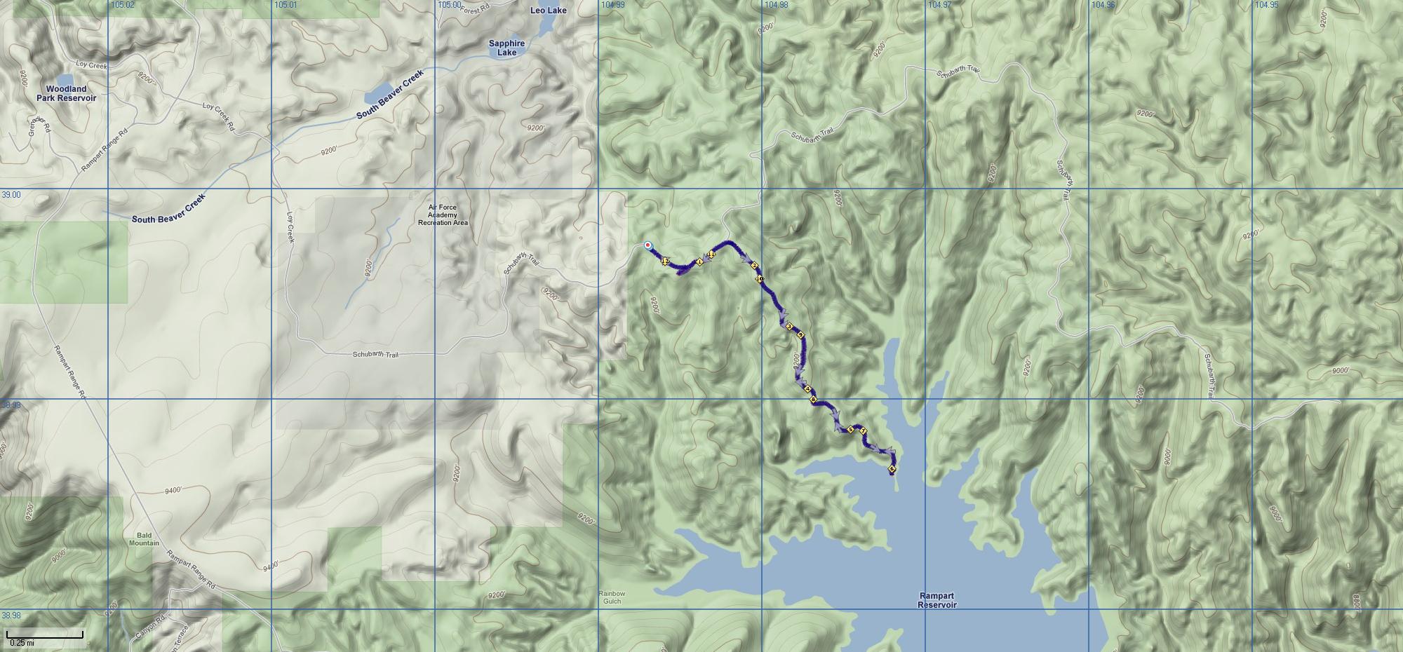
Terrain View
Reservoir Trail
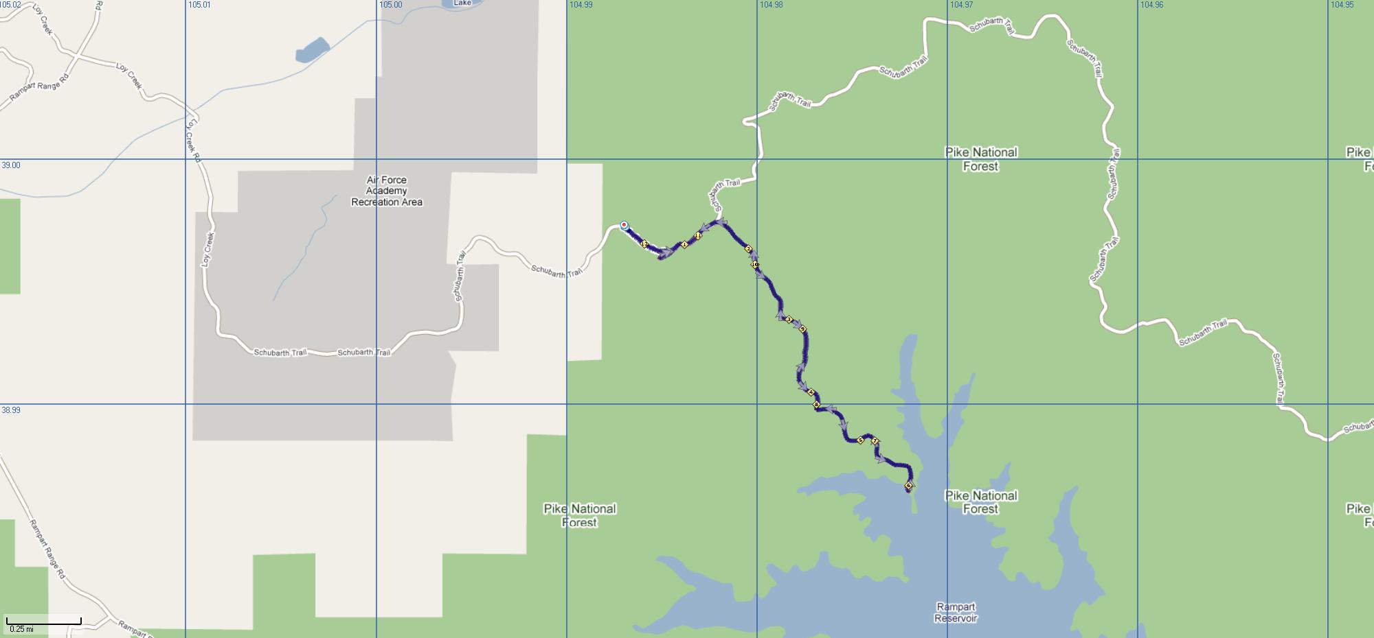
Street View
Reservoir Trail
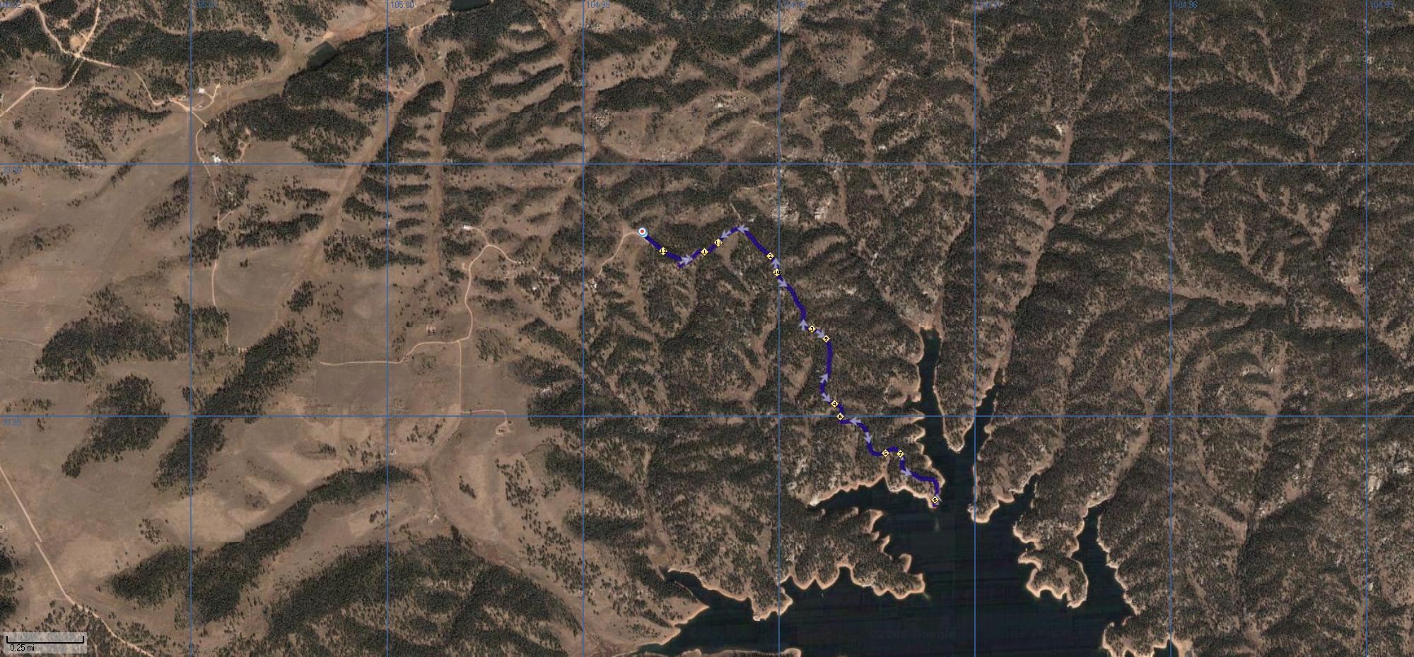
Satellite View
Reservoir Trail
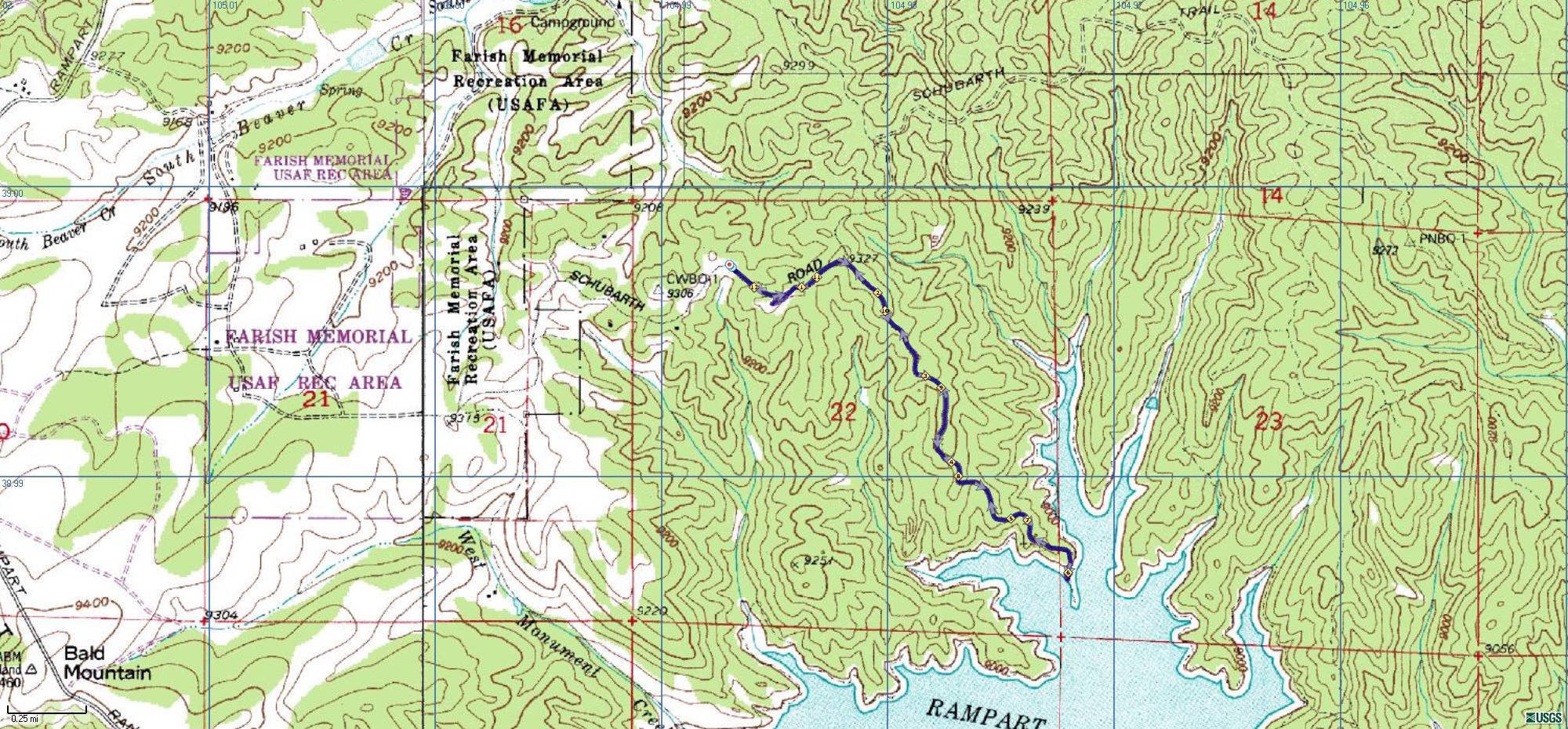
Topo View
Reservoir Trail
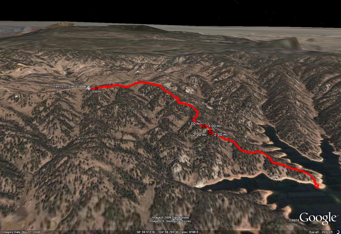
3D View
Reservoir Trail
Reservoir Trail
Reservoir Trail
Reservoir Trail
Reservoir Trail
Reservoir Trail
Reservoir Trail